Mapping Manchuria. A brief study on the Territorial Map of Military Deeds in Shengjing, Jilin, and Heilongjiang
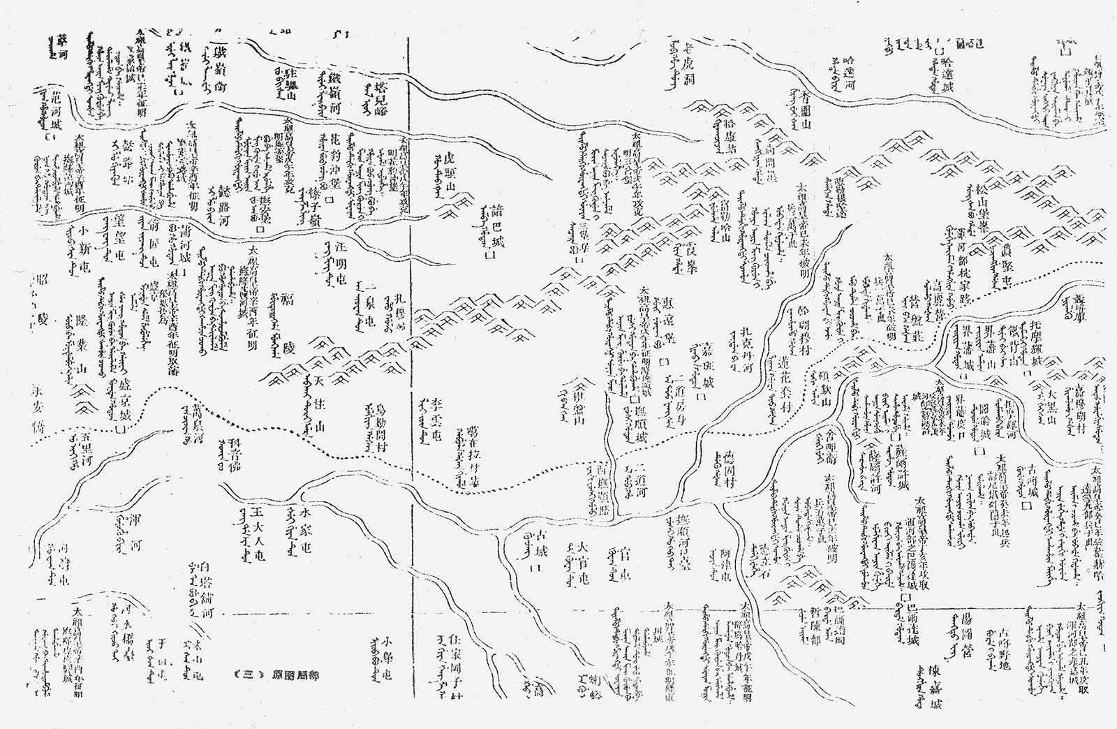
In 1775, the Qianlong emperor (reigned 1735–1796) read through the Old Manchu Archives [Manwen laodang 滿文老檔] and discovered that they mentioned many places in Manchuria, but he could not find a map that showed the location of these places. As he considered it important to have a map of the homeland of his ancestors, and in order to preserve the Manchu identity, he initiated a mapping project of this region, resulting in the Territorial Map of Military Deeds in Shengjing, Jilin, and Heilongjiang [Shengjing, Jilin, Heilongjiang dengchu biaozhu zhanji yutu 盛京吉林黑龍江等處標註戰績輿圖]. Qianlong’s goal for this Map of Military Deeds was to commemorate his ancestors and to display the military achievements of the conquest in China’s northeast before the Manchus had established Beijing as the capital of the Qing in 1644.
To make the map, Qianlong ordered officials to check the Old Manchu Archives, the Gazetteer of Shengjing [Shengjing zhi 盛京志], and the Venerable Records [Shilu 實錄] and to list place names mentioned in these sources. Qianlong wanted the lists to be sent to the garrison generals of Shengjing, Jilin, and Heilongjiang so they could survey their provincial capitals and surrounding areas. They were supposed to measure the distance between the places and the provincial capitals, to check if places had changed their names, and to see if there were any famous mountains, rivers, and stories connected to these places about the Manchu ancestors. They would then compile a single map of the three provinces.
The officials followed Qianlong’s order and surveyed north-eastern China. They used one of the Qianlong editions of the Overview Maps of Imperial Territories (see Mario Cams’ essay in this issue) as the basis for their new map and through this large-scale investigation, more than 700 places were identified, which had not been indicated on the Overview Maps. On 20 May 1776, the Shengjing governor-general Hong Shang弘晌 (1718–1781), sent a folded draft map of the three provinces Shengjing, Jilin, and Heilongjiang to the emperor, with red labels affixed to places in Shengjing, pink labels affixed to places in Jilin, and white labels affixed to places in Heilongjiang. The Qianlong emperor decreed, “Use the draft of the map of places such as Shengjing and Jilin [as a base] for drawing a comprehensive map, and make annotations on the map describing the various [military] achievements [of the Manchu people] in Manchu and Chinese”.1
The main editors of this map, the ministers Šuhede (1710–1777), Agūi (1717–1797), and Ingliyan (1707–1783) proposed to enlarge the dimensions of the map. They sent the following memorial in the summer of 1776, suggesting a format that was eventually used for the annotations of military deeds: “…All the achievements that happened at certain places [mentioned] on the map will be described [as a note] under the respective place name with the year and month the achievement took place indicated”.2
The note next to Sarhū Mountain, for example, reads: “In the third month of the fourth year Tianming 天命 [April/May 1619], 470,000 Ming soldiers came to attack from different directions and so Emperor Taizu 太祖 [Nurhaci, 1559–1626] gathered 60,000 soldiers in this place”.

Fig.5: The Territorial Map of Military Deeds in Shengjing, Jilin and Heilongjiang.
The editors combined 2,313 place names – of which over 700 appeared on a map for the first time – with 144 annotations in both Manchu and Chinese. It took them two years to complete the map project and in May 1778, the Map Bureau [Yutu fang 輿圖房] requested compensation for the work. By that time, Šuhede had already passed away, so Agūi had become the minister in charge of the project. Two months later, in July 1778, Agūi, together with other ministers presented the map to the emperor. The Map of Military Deeds was handed over to the Hall of Military Excellence [Wuying dian 武英殿] for publication in March 1779 and was subsequently printed.
This map made by the Qing government added more than a third of place names compared to previous maps. This way, the north-eastern borderlands became much better known and the map is a valuable document for studying Qing dynasty knowledge of the borderlands and the place names of the people at the north-eastern border.
Gu Songjie is Assistant Professor at the Academy for Research on Chinese Ethnic Minority Languages, Minzu University of China (gusongjie1010@163.com)